Geography: Three Major Lakes
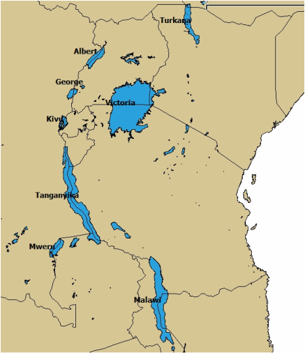
Lake Victoria
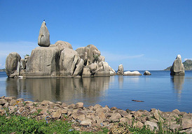
Lake Victoria (Victoria Nyanza) is the second largest lake in the world (Lake Superior is the largest) with an area of 26,828 square miles. The coastline exceeds 2,000 miles. The southwestern coast has precipices 300 feet high. On the western coast, papyrus and swamps mark the delta of the Kagera River. The northern coast is flat and bare, with a narrow channel that leads into Kavirondo Gulf. This channel has an average width of 16 miles and extends for 40 miles to the east towards Kisumu, Kenya. Kampala and Entebbe in Uganda are on or near the northern coast of Lake Victoria. In the northwestern corner is the Sese archipelago with 62 islands (some are quite pretty). Speke Gulf is on the lake's southeastern corner. Near Speke Gulf is Ukerewe, the largest island in the lake and densely populated. The Emin Pasha Gulf is at the southwestern corner. The Kagera and Katonga Rivers flow into Lake Victoria while Lake Victoria flows into the Nile. Lake Victoria has more than 200 species. Of these, the Tilapia is the most important, economically. Around Lake Victoria is one of the most densely populated in Africa. Several million people live within 50 miles of the shores and nearly all of them are Bantu-speaking.
Lake Tanganyika
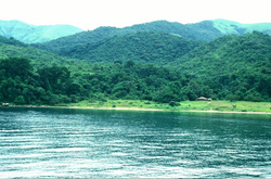
Lake Tanganyika is the second largest of the lakes in the region. It is the longest freshwater lake in the world (410 miles) and the second deepest (4,710 feet). However, it is rather narrow, only 10 to 45 miles in width. It covers about 12,700 square miles and forms the boundary between Tanzania and Congo. The waters tend to be slightly salty and most of the time the land rises steeply from the shore. Many rivers feed into Lake Tanganyika; the most notable are the Malagarasi, Ruzizi, and the Kalambo, which has one of the highest waterfalls in the world (704 feet). Lake Tanganyika flows into the Lukuga River. It forms part of the line that divides the floral regions of eastern and western Africa and contains many oil plams along its shores. Rice and subsistence crops are grown on the shores and, like the other lakes, there is quite a bit of fishing. The bird life is varied and there are many hippopotamuses and crocodiles. Many of the Bantu-speaking people living on the lake's eastern side can trace their origins to areas in the Congo River basin. Lake Tanganyika has many important ports in multiple countries.
Lake Malawi
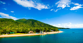
Lake Malawi is also called Lake Nyasa. It is the third largest of the lakes in the region. It is mainly within Malawi, though its middle line and northern and eastern shores form a lot of Malawi's boundary with Tanzania and Mozambique. Its length from north to south is 363 miles and the width varies from 10 to 50 miles. The area of Lake Malawi is 11,430 square miles. In the northern end, the depth increases to 2,310 feet. At this end of the lake, the precipices of the forested Livingstone Mountains (on the east side) and the Nyika Plateau and Viphya Mountains (on the west side) come down to the lake shore. Halfway up the lake is Likoma Island, which is the site of an Anglican cathedral and a mission headquarters. From May to August, Lake Malawi experiences a southeasterly wind called the mwera. This wind causes short gales and restless waters, with the coastline offering little shelter. Lake Malawi is fed by 14 perennial river (the largest is the Ruhuhu) and flows into the Shire River. Like Lake Victoria, the most important fish, economically is the Tilapia, which the commercial fisheries are based on. Though, overfishing, using nets with a smaller mesh size than recommended, and disregard of the ban on fishing during the breeding system has caused detrimental effects on the fish population. Lake Malawi contains many important ports, as goods are often transported across it.
Video of Lake Malawi
Video of Victoria Falls. Victoria Falls is a famous waterfall. The local people call it "Mosi-oa-Tunya" (the smoke that thunders. The falls are 1,708 meters wide, which makes it the largest curtain of water in the world. It drops between 90 meters and 107 meters into the Zambezi Gorge. An average of 550,000 cubic meters of water plummet over the edge every minute.
Sources:
"Lake Victoria." Encyclopaedia Britannica.
"Lake Nyasa." Encyclopaedia Britannica.
"Lake Tanganyika." Encyclopaedia Britannica.
"Victoria Falls."
Images:
"Great Lakes Map."
"Lake Victoria Tours."
"Lake Malawi Photo."
"Tanganyika- Gombe Stream Lake."
Videos:
"Part 13 Africa Malawi Lake."
"Part 10 Afrika- Zambia Victoia Waterfalls (Şelalesi)."
